
THERMAL WILDLIFE SURVEYS AND LAND INTELLIGENCE
SEE WHAT THE LANDSCAPE IS HIDING
Levity combines thermal and high-resolution aerial imaging to help landowners, property managers, biologists and hunting lease operators better understand wildlife populations, movement, and habitat use across their property.
Actionable wildlife intelligence for better land-management decisions.
FAA Part 107 Certified | Thermal + RGB Surveys | Aerospace Engineering | Based in Tulsa, OK

Thermal detection

Visible light
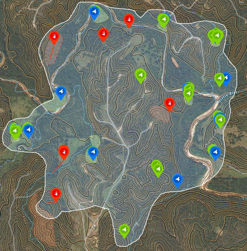
WILDLIFE LOCATION MAPPING
Notable wildlife observations are recorded with GPS locations, species identification, and direction of travel, then organized into an easy-to-use property map. This helps reveal movement corridors, congregation areas, predator activity, and portions of the property that may require further attention.
Wildlife Surveys
Levity Land Intelligence LLC provides detailed wildlife surveys and land analysis using advanced thermal imaging, aerial mapping, and data processing. Our reports help landowners understand wildlife activity, habitat conditions, and opportunities for meaningful property improvement.

TERRAIN AND HABITAT ANALYSIS
Detailed aerial and topographic maps provide a broader understanding of terrain, vegetation, drainage, access, and habitat conditions. These insights can support decisions about prescribed burns, invasive-species removal, native cover planting, water management, and other property improvements.

POPULATION ANALYTICS
Survey observations are summarized into clear population metrics, including estimated herd composition, buck-to-doe ratios, fawn recruitment, and other visible indicators of wildlife health. These findings provide a practical baseline for evaluating management goals and tracking changes over time.
THE MISSION
Modern Land Stewardship
We believe the land is part of God’s creation and that caring for it is both a responsibility and an opportunity.
Levity helps landowners better understand their property and make meaningful, informed improvements that support healthy wildlife, resilient habitat, productive land, and the long-term health of the environment.
By combining modern aerial intelligence with responsible land-management practices, we aim to help our clients care well for the land entrusted to them—and preserve it for generations to come.

Other Capabilities


Thermal Animal Recovery
Prescribed Burns
Solar / Roof Inspection
Disaster Support
Wildlife, Nature & Land Videography

Know What's Living on Your Land
_mp4.jpg)